Description
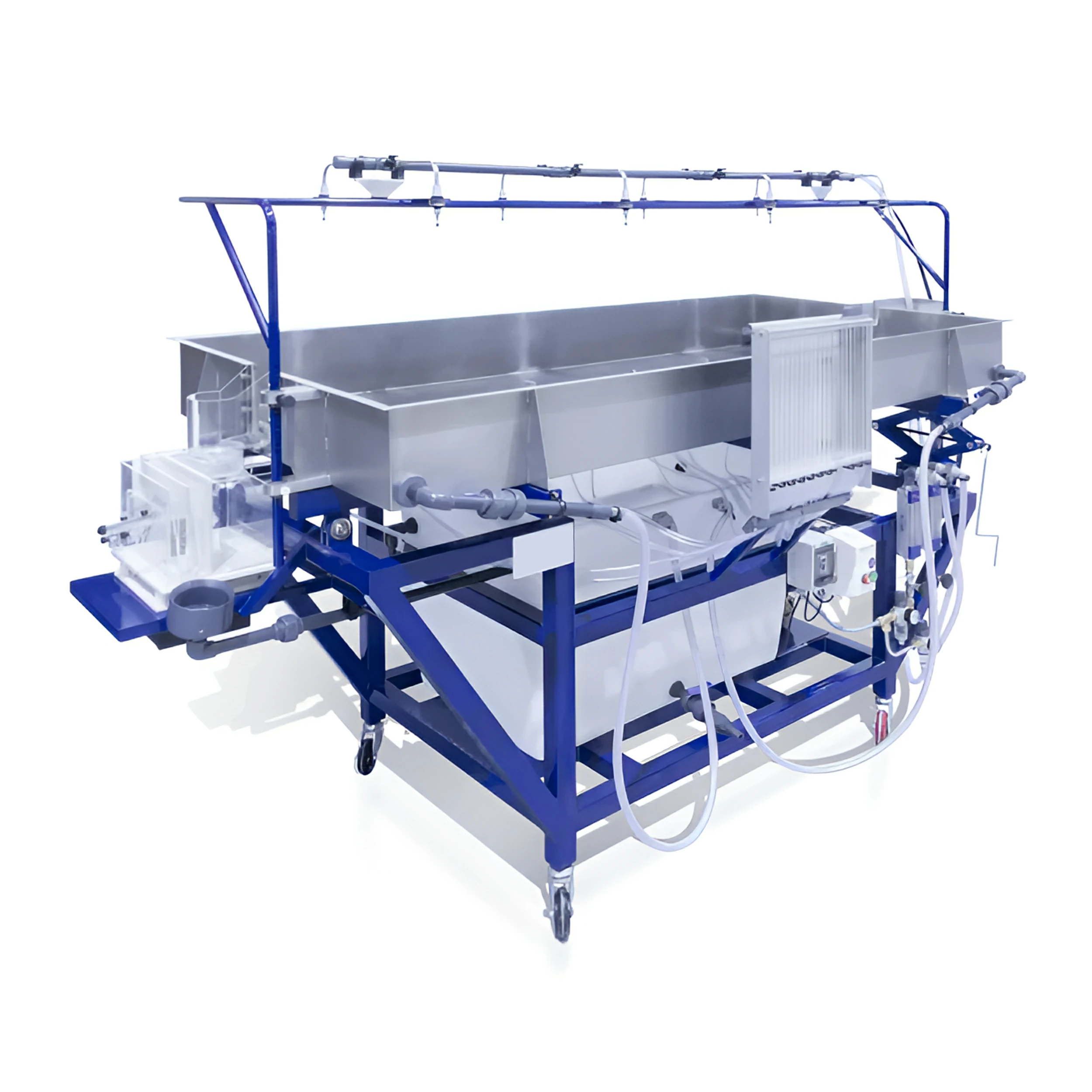
The S12-MKII-50 Advanced Environmental Hydrology System is unique in its capability, with features suitable for studying fluvial geomorphology which include: rainfall/runoff hydrographs for catchment areas of varying permeability; the abstraction of ground water by wells, both with and without surface recharge from rainfall; the formation of river features and unique to this apparatus, fluvial mechanics.
Realistic results can be obtained from this small-scale, floor standing apparatus, which can be conveniently located and requires no special services.
The unit comprises a sand tank, made of stainless steel, measuring 2 x 1 metres. Water may be input to the sand tank from spray nozzles located above the tank (simulating rainfall) from an inlet tank simulating a river flow or from two French drains buried in the sand at either end of the tank. The water is output either from an outlet tank and flow measurement system located at the end of the main sand tank, from one or both of the two wells located in the tank, or from one or both of the French drains. A large plastic sump tank is located under the sand tank.
Ground water table levels (phreatic surface) are measured using 20 tapping points in the sand tank, configured in a cruciform pattern, and displayed on a manometer bank.
Eight spray nozzles are mounted on a gantry above the sand tank, positioned to give an even distribution across the tank surface. The height of the gantry can be easily adjusted. Each nozzle has an associated on/off valve, allowing a wide variety of moving rainfall patterns to be simulated.
The river inlet tank uses glass balls to still the flow and a shaped channel section to provide formed flow conditions into the sand tank. The subsurface flow inputs are via two French drains, buried in the sand at either end of the tank. These French drains extend the full width of the tank. Each drain can be configured as an inlet or an outlet to permit a wide variety of hydrological demonstrations.
Two variable area flow meters with integral adjusting valves are used to control and measure the various flows into the tank. The use of self-sealing quick-release fittings allows the system to be configured in a variety of different ways, enabling a wide range of demonstrations.
The two flow meters have different ranges, further enhancing the flexibility of the overall system. Pressure regulators and filters are incorporated in the water supply lines, minimising system disturbances.
The outlet tank is located at the end of the sand tank, and is used for hydrographs, runoff and river formation demonstrations. A stepped height weir is used to adjust the outlet conditions. When performing water table demonstrations this stepped weir is replaced with a sealing plate. The outlet tank comprises a sand trap, a water stilling system and a flow measurement device. The flow measurement is performed by measuring the height of the water flowing over the outlet weir, using a direct reading inclined manometer.
The sand trap is configured to allow the sediment to be collected in a sieve. In this way the amount of sediment collected over a period of time can be measured.


Reviews
There are no reviews yet.